+
.com
USD
  • Account
  • Sign Up
  • Sign In
You have no items in your shopping cart.
ABOUT 1OUTLETS
Home Shopping Books Reference Atlases & Maps Rand McNally Easy to Read: Delaware, Maryland State Map
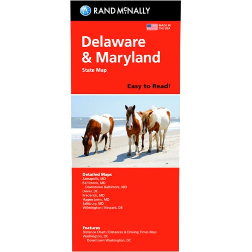
Rand McNally Easy to Read: Delaware, Maryland State Map

Rand McNally Easy to Read: Delaware, Maryland State Map

Author

Rand McNally

( 352 reviews ) See Reviews (1Outlets)

In stock *In Stock - Subject to stock availability at point of fulfilment. In the event whereby the item is out of stock or unable to provide the service, 1Outlets will cancel the order and issue a Full refund in-store credit to you. SKU : e3ec852fadc237761fef5b8d2df4c6e3

USD6.07
  • Buy 2 for USD5.47 each and save 11%
  • Buy 10 for USD5.05 each and save 20%
Qty:

**Free Shipping Worldwide available - Shipping time may vary depending on the address.

**Circumstances Reroute - This is a time of great stress and uncertainty. We are actively validating, routing and re-routing orders with our overseas merchants, logistic partners and airlines. Deliveries and supply may expect delays.

**In Stock (Low Inventory Warning) - Subject to stock availability at point of fulfilment. In the event whereby the item is out of stock or unable to provide the service, 1Outlets will cancel the order and issue a Full refund in-store credit to you (See Refunds).

**Report or Request Removal  - Any copyrighted, DMCA, inappropriate, offensive, prohibited, potentially Illegal Listings (Submit doc here).

Details

Explore Delaware & Maryland with Rand McNally!

Rand McNally Easy to Read: Delaware, Maryland State Map is a colorful, kid-friendly, travel companion for young adventurers. This map is perfect for your road trips, school projects, and family vacations! With clear easy-to-read details, and illustrations for fun and understanding, your entire family can locate landmarks, historical sites, and exciting destinations across Delaware and Maryland!

Main Features

  • Visually appealing design: Bright colors and engaging illustrations make learning fun and inspiring for young explorers.
  • Clear and concise information: Detailed place names and important landmarks are shown in an easy-to-follow format.
  • Large print: The map uses large print to make it simple to read and understand at a glance.
  • Essential landmarks: Features key historical locations, tourist attractions, and parks for a fun learning experience.
  • Perfect for young travelers: Created with a focus on making travel accessible and exciting for children and teens.

Benefits

  • Enhances geographical knowledge: Visualizing location strengthens understanding and fosters a deeper connection to these eastern states.
  • Promotes independent travel: Kids can use the map to find their way around cities and towns while traveling, cultivating confidence.
  • Supports learning: The map can aid in classroom projects, school assignments, and educational exploration of history and geography.
  • Fosters family bonding: Sharing this mapping experience brings families together, creating lasting memories.
  • Develops essential skills: The map encourages spatial reasoning and problem-solving skills by promoting navigation and understanding of the world.

Unique Selling Points / Competitive Advantages

  • Kid-friendly illustrations: Engaging illustrations capture the attention of children, making geography more inviting.
  • Easy-to-understand layout: The map's clear design and large print ensures readability and simplicity.
  • Focused on exploration: Highlighting key destinations fosters curiosity and encourages outdoor adventures.
  • Perfect for travel: A portable and convenient guide for families, schools, and educational settings.
  • Commitment to quality: Rand McNally guarantees the accuracy and dependability of the mapping.

Usage Scenarios

  • Family road trips: Navigate new areas together and pinpoint destinations easily.
  • School projects: Use the Delaware and Maryland map to research historical sites or tourist attractions for presentations.
  • Educational activities: Incorporate the state map into engaging learning games and interactive sessions.
  • Outdoor adventures: Locate parks, trails, and other scenic spots for memorable explorations.
  • Travel planning: Use the map to plan future trips to specific landmarks and locations.

Customer Reviews / Testimonials

  • Maria Rodriguez, USA, 2023: "My daughter loves using this map! It's so clear and fun, she's already memorized the locations of all the parks!"
  • Ahmed Ali, Egypt, 2024: "This is a fantastic resource for our family's road trips! The maps are easy-to-read, especially for children."
  • Olivia Smith, Canada, 2023: "Our son's school project on the local landmarks was a breeze with this clear Delaware Maryland map.

Frequently Asked Questions

  • Q: Is this map suitable for children? A: Yes, the Rand McNally map is designed with young children in mind, featuring colorful visuals, large print, and easy-to-understand information.
  • Q: Can I use this map for school projects? A: Absolutely! The detailed landmarks and clear layout make it an ideal resource for school assignments and research.
  • Q: How portable is this Rand McNally map? A: It's compact and easy to carry.
  • Q: How accurate are the Delaware and Maryland locations? A: Rand McNally ensures accuracy, making the map dependable and trustworthy.
  • Q: Is there a glossary? A: While there are no glossaries, important locations are marked with clear labeling.

BUY NOW

Get ready for unforgettable family adventures with the Rand McNally Easy to Read: Delaware, Maryland State Map today!

(Beta: User Generated 2024.0007)
Specification
Category: Books > Reference > Atlases & Maps
Author:

Rand McNally

Weight: 0.04535923696kgs
Language: English
ISBN-13: 978-0528025686
Terms & Warning